Two weeks after my epic mountain adventures in Mindanao, I needed to
travel to the City of Pines to use an expiring hotel accommodation
voucher. A trip too sudden without any plan gave me an idea to hike a Cordillera mountain which, for some reasons, I've never done before. Mt. Timbac (
or Mt. Timbak or Mt. Singakalsa), the 3rd highest in Luzon and 9th in the country, turned out to be my 36th mountain.
________________________________________________________________________________
Saturday - February 9, 2013
Rather than kill my time at Baguio City (
doing nothing), I went to Mt. Timbac for a quick day hike. With me is my blogger friend, Byron of
peculiarhours.com, a photographer/landscape architect who, just recently, also found love in hiking mountains.
| Mt. Timbac is one Cordillera mountain that's easily accessible by commute from Baguio City. Its jump off, km 55 of Halsem Highway, is just 3 hours away from the city. Buses bound for Bontoc or Sagada plies the route.
As soon as we arrived at Baguio city early in the morning of Feb 9th, we headed straight to Dangwa Terminal to catch the first bus bound for Sagada. We had to be there early so that we won't get caught by the great influx of passengers going to Sagada (
Sagada-bound tourists would always come in number if it's a weekend).
 |
Obviously, we made it in time. At around 05:45 AM, the first bus went off to Halsema Highway.
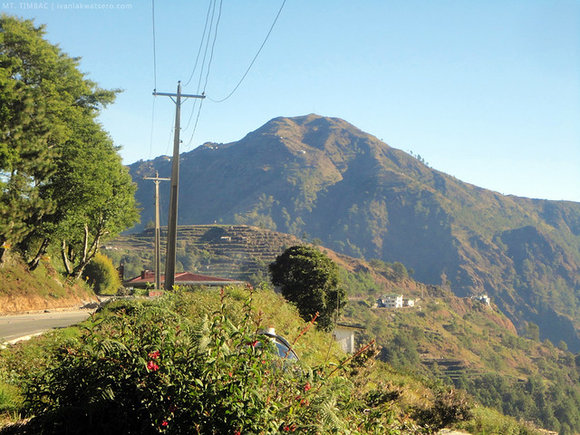
Here's a photo of Mt. Timbac from Halsema Highway. Despite its easy access, ewan ko ba, for some reasons, ngayon ko lang siya aakyatin. |
 |
| Mt. Tabayoc (Luzon's 2nd) and Mt. Pulag (Luzon's 1st) seen from Halsema Highway. |
By 08:45 AM, a few minutes after passing by the "Highest Point in Philippine Highway System" marker, the bus conductor signaled that we're already at km 55 of Halsema (
funny to think that sources in the internet were too accurate, exactly three hours from the time we left Baguio City, we reached km 55).
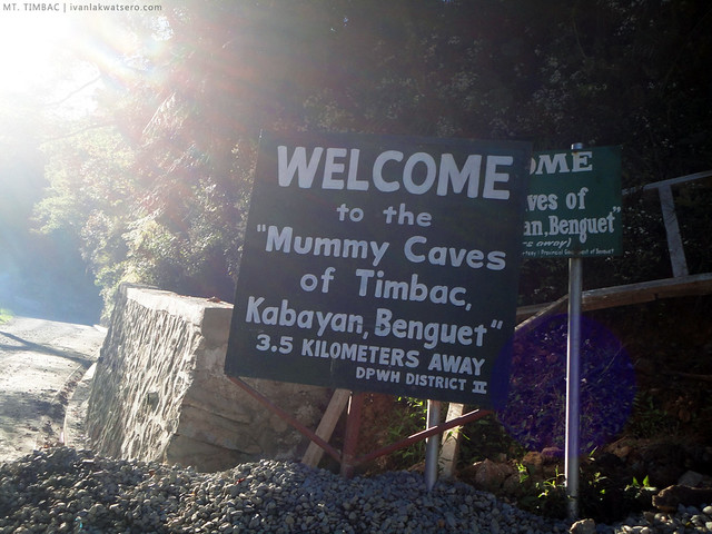 |
| this marks KM 55 |
Compared to my previous hikes in the Cordilleras, trekking up to the summit of Mt. Timbac was too fast and very easy. A trouble-free trek along a concrete road makes up the first 45 minutes, then after that, the summit would be just 15 minutes away. One hour of trek in total.
Parang nag-jogging lang kami somewhere sa Manila.
 |
| easy trek along a concrete road |
Our trek on the early parts of the concrete road, however easy, was quite an unremarkable experience. What I saw on the road, just concretes and piles of rock, did not excite me at all.
In fact, sobrang tinatamad ako sa mga oras na 'yon. I must say, nothing really beats a green forest trail. But then on second thought, the beauty of Mt. Timbac does not lie on its trail.
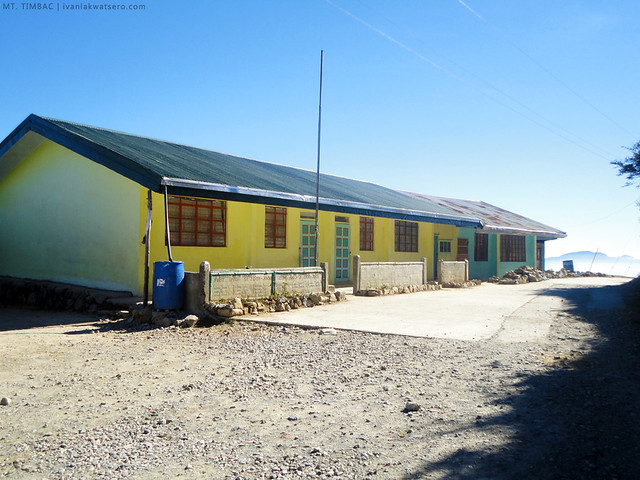 |
| 20 minutes into trekking, we reached Mongoto Elementary School |
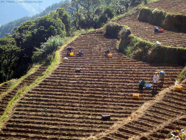
I learned to appreciate Mt. Timbac only after the views of vegetable terraces and nearby Cordillera mountains appeared in the horizon. The rural scenes with the great Mt. Pulag and Mt. Tabayoc at the back drop was simply a sight to behold.
 |
work work!
a usual scene in the mountains of Benguet |
 |
| Mt. Tabayoc, the 2nd highest in Luzon |
 |
| and Mt. Pulag, Luzon's highest. |
 |
| there's a junction not too far from the school. That upward road will lead you to summit |
A few moments after we took the upward road not too far from the school, a scene of wider, more complex vegetable terraces suddenly came into sight. I was so wowed, greatly wowed, by this scene. It was so beautiful that it almost matched those rice terraces in Ifugao.
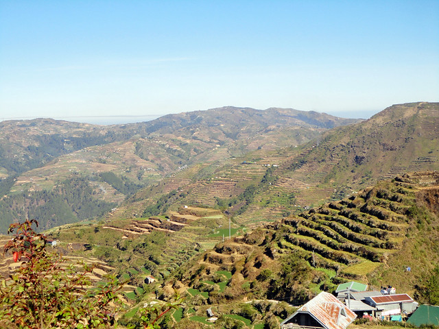 |
| If not for these scenic views, I might put Mt. Timbac in my list of least favorite mountains. |
 |
the summit of Mt. Timbac.
we're almost there. |
We were about to take the downward dirt path (
yes, nag-degrade yung concrete road to dirt path habang palapit kami sa summit) when an old woman told us that we're taking the wrong way. She directed us to the trail just right beside her house. Big to thanks to her!
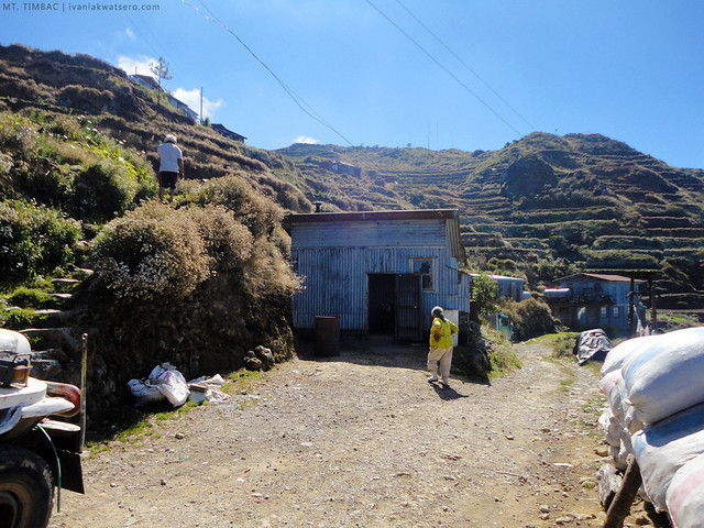 |
that's the old lady who showed us the right way.
the stairs on the left of this picture is the right way to the summit. |
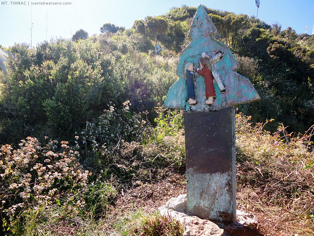 |
| just follow these Stations of the Cross markers, and you will surely reach the summit. |
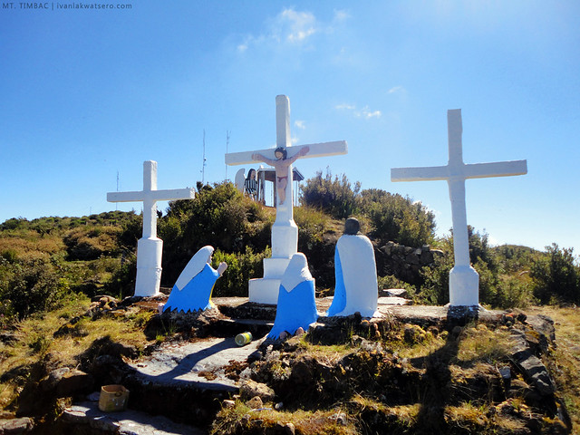 |
| exactly one hour from km 55, we arrived here. |
It was around 09:45 AM when we reached the crucifixion area. From that spot, my eyes almost popped out. I was surrounded by amazing scenes - Benguet's grand complex of vegetable terraces, as well as the great Cordillera mountains Mt. Pulag and Mt. Tabayoc.
 |
| grand vegetable terraces of Benguet |
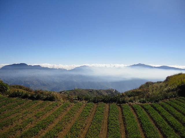 |
| Luzon 1-2-3: The highest and the 2nd highest, seen from the third highest |
Although many refer to Mt. Timbac's Crucifixion scene as its summit, it
is not. The real summit can be found further up where the
power lines are connected which is just a stone's throw away. There was, however, no clear trail leading to the real summit (or maybe we just failed to see it). But that's not a valid reason not to pursue for it.
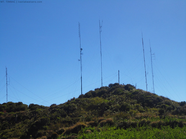 |
| almost at the summit |
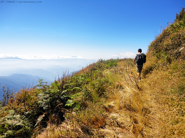 |
| Through the overgrown tilled soil, we hacked our way to summit |
Finally, after about 5 mins, we reached the summit. We also found there the GCP of Mt. Timbac.
 |
Geodetic Control Point (GCP) of Mt. Timbac.
These markers are usually placed in key points (commonly the highest point in an area) that are critical in land surveying. |
At the summit, we spent only a few minutes taking photos of the surrounding landscapes. The sun quickly became too harsh that we needed to leave right away.
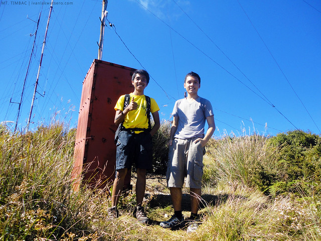 |
| and here's our summit photo |
We knew that Mt. Timbac, aside from being the 3rd highest in Luzon, is also known for it's mummy caves. Ancestors of the people who lived in this mountain used to mummify their dead and keep them in its caves. So before we trekked back to highway and travel back to Baguio City, we explored the place for these mummies.
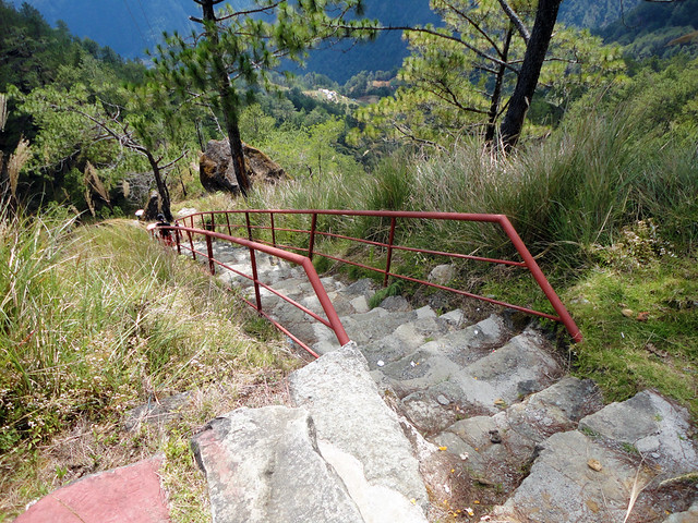 |
| we found the stairway to the mummy caves, located just a few minutes walk from the junction. |
Incidence of mummy-stealing made the locals put gates on the caves. Thus, we failed to see the actual mummies inside. The care taker said that they would open it only if you have special permit.
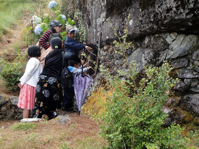 |
| Please keep in mind that the caves are a sacred place, taking any photo of the mummies/coffins even from the outside of the cave might offend the locals. |
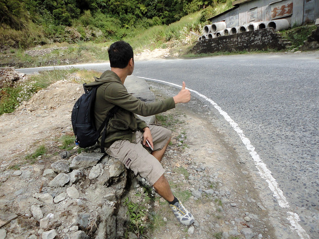
When we felt that our business at Mt. Timbac was over, we started our descent through, again, the concrete road. And in no time, we're back at km 55 of Halsema waiting for a bus to Baguio City.
______________________________________________________________________________
Done with the 3rd highest of Luzon.
We would've done a traverse of Mt. Timbac to the other side (Kabayan, Benguet), but everything seemed to be stopping us - first, I
felt sick while we were attempting the traverse; second, I ran out of
hydration; and third, there will be no more public transpo from Kabayan
going to Baguio by the time we finished the traverse.




our team is planning to climb mt. pulag soon. plausible kaya na isingit to as side trip?
ReplyDeletepossible naman, you can drive to Kabayan Bario to access Mt. Timbac.
DeleteThis comment has been removed by the author.
ReplyDeleteibang klase ka talaga sir ivan...
ReplyDeleteup for your upcoming mountaineering exploits...
will look forward to your posts...
Congrats!
ReplyDeleteI love the photos.
haven't been here... hope to join one of your adventures :)
ReplyDelete