No man has ever hiked the same mountain twice, for in every hike, the experience is never repeated.If you're a constant reader of this blog, then you know for sure that Mt. Makiling (a MakTrav dayhike) is the blogger's personal favorite. But did you know that there's a mountain up north that gives an equivalent thrill as MakTrav? If Mt. Makiling is to south, for me, Mt. Arayat is to north. I don't think I will ever get tired of hiking both Makiling and Arayat, my favorite mountains, my training grounds.
Last Sunday (Jun 2, 2013), I did a traverse, yet again, on Mt. Arayat — same route (Magalang to Arayat). Well, it never gets old, the excitement, fun and thrill that I felt more than a year ago during my first Arayat Traverse is exactly the same feelings that I felt on my fourth.
So what happened on my 4th Mt. Arayat Traverse? here's a quick run through:
Commute to the jump-off
Catching the Magalang-bound jeeps early in the morning (5-6 AM) is quite a challenge you know, That's why in my previous traverses on Mt. Arayat, we always end up taking a hired vehicle (van/jeep) from the drop-off points (either SM Pampanga or Dau Bus Terminal) to the jump-off in Brgy. Ayala, Magalang.
But last Sunday, we reached the Magalang jump-off purely by commute. hurrah! From Manila, we traveled by bus (4:30 AM trip bound for Olongapo) to San Fernando, fare was P102 and travel time was about 2 hours. It was around 6 AM when we alighted the bus in front of SM Pampanga. There, we were advised by the taho vendor to wait for the first Magalang-bound jeep coming from the bayan of San Fernando as it will arrive anytime soon. The jeep did arrive after 30 minutes or so, fare from SM Pampanga to Magalang was P35, travel time was about 30 minutes. Lastly, at Magalang town, we rode a trike (terminal is located a few blocks from Magalang Municipal Hall) to the jump-off at Brgy. Ayala. Fare was P70 if until the Campo (registration site), P100 if until the end of the concrete road.
 |
A 2nd registration site at the jump-off
It wasn't there the last time I did Arayat Trav!
Originally, when climbing Mt. Arayat, you would have to register twice, first at the military camp at the base of the mountain and second at the communication tower at the north peak. No required fees. But last Sunday, surprisingly, there's now a 2nd registration site at the base of Mt. Arayat, located at the trail head of Magalang Trail.
This 2nd registration site was put up by DENR after their recent visit/inspection in Mt. Arayat. Again, no registration fees needed.
 |
| DENR station at trail head of Mt. Arayat |
New Trail vs Traditional Trail
Roots, rocks and boulders — I think these are the words that would best describe the traditional trail. Perhaps, 70% of the whole traditional trail is made up of these.
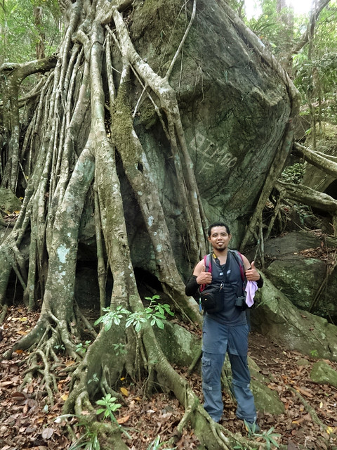 |
| Roots... |
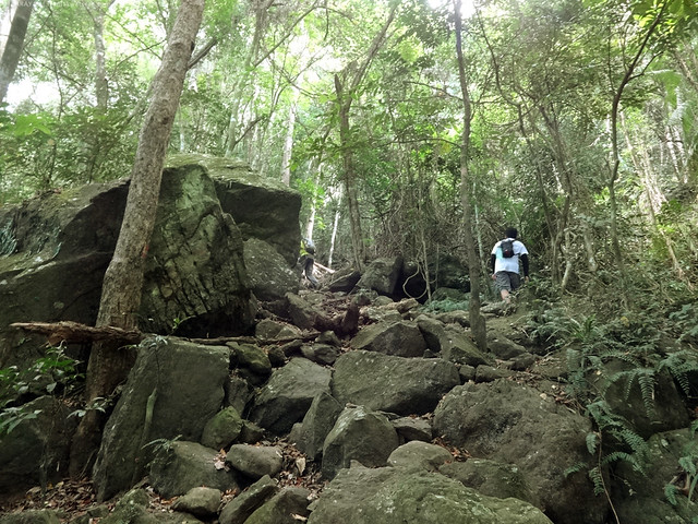 |
| boulders and rocks... |
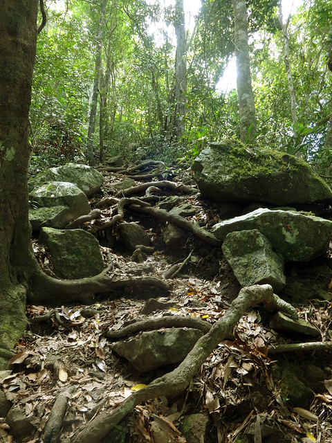 |
| and a combination of the three. |
 |
| huge boulders along the trail to white rocks view deck |
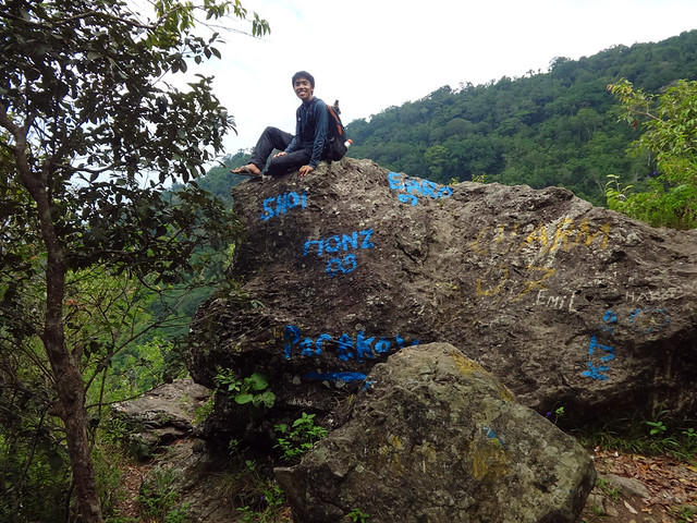 |
| the White Rocks view deck offers a view of the plains of Central Luzon. But in this photo, look at the insolence of some of the visitors of Mt Arayat. |
The New Trail (or Poste Trail), on the other hand, will take you directly to North Peak, bypassing the White Rock, thus a quicker route. It is, however, not as scenic as the traditional trail, quite unremarkable, and purely ascending.
 | ||
| The new trail (poste trail). This photo was taken during my third Arayat traverse last November 2012. We accidentally have taken the trail which was, by that time, newly created. An account of my 3rd Arayat traverse in this link. |
Past the talahiban area, the single trail will diverge into two, to the left is the New Trail and to the right is the Old Trail. A kubo will serve as your landmark.
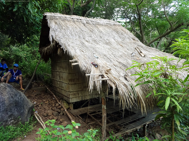 |
| the single trail will diverge into two once you see this kubo. |
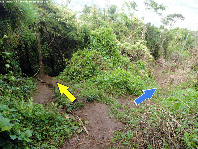 |
| this photo, taken from my hike last Nov 2012, shows where the old and new trails meet again. Yellow Arrow = Traditional Trail Blue Arrow = New Trail |
Hikers This Way
Another change that I noticed in my 4th Arayat hike is that the military camp at the north peak now has a perimeter fence. Hikers are no longer allowed to get near the communication tower, and are rerouted towards a new trail on the side.
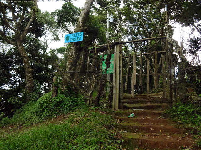 |
| Hikers that way! |
North Peak - Haring Bato - South Peak - View Deck - Brgy. Juan Baño
Trekking from North Peak to South Peak is as refreshing as ever. I won't be discussing much in this post, just look at the photos that follow!
 |
| View from the North Peak. click the photo to enlarge. Time: we reached the area at 11:00 AM and left at 11:45 PM |
 |
| Pampanga and Zambales mountains (Mt. Pinatubo) as viewed from Mt. Arayat's Haring Bato. Time: 12:37 PM |
 |
| The 80 degrees boulder challenge, this is my most favorite part in the whole traverse. Time: 12:45 PM |
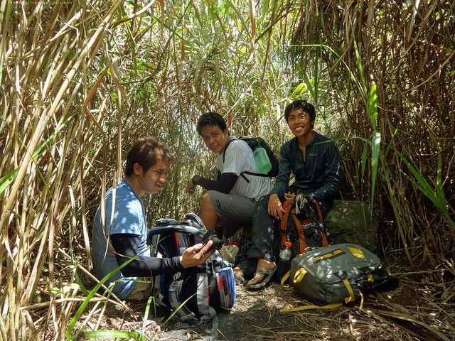 | |
| At the grassy South Peak. Time: 01:20 PM |
 |
| this view deck is probably Mt. Arayat's ultimate photo ops. We spent more than 30 mins here taking selfie and groupie photos Time: we reached the area at 01:30 PM, and left at 02:10 PM |
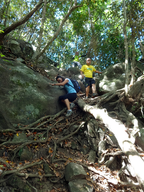 |
| Descending the exciting trail of Mt. Arayat (southern side) Time: 02:55 PM |
 |
| Concrete road again at Brgy. Juan Baño! Finished the traverse after 8 hours. Time: 04:05 PM |
Another hike in Mt Arayat has been completed. Yahoo! Salamat sa mga kasama ko sa hike na ito.
______________________________________________________________________________
Read also my previous hikes in Mt. Arayat. Check them out!
1st Arayat
2nd Arayat
3rd Arayat

Salamat Idol! Well said! Tunay ngang napakaganda ni Arayat! Babalik balikan talaga!
ReplyDeleteayos, wala naman sigurong NPA tulad ng laging kwento sakin...
ReplyDeletepangarap ko na yan akyatin nung bata pa ako,
kasabay ng Makiling sa SLEX :D
sana this year maakyat ko sya :)
ayos, wala palang NPA jan tulad ng sabi ng iba
ReplyDeleteMeron sir, hindi lang sila nagpapahalata. Mababait naman sila so no worries.
ReplyDeleteOMG! okay na sna kzo biglang may "NPA" topic....hindi na ako pupunta jan...
Deleteanother mountain for me... so near yet so far.. haven't been here.
ReplyDeletecongrats :)
si master Trajan ulit..? angas! - Enteng
ReplyDeleteyun po bang fence na ginawa ng military camp sakop pa din yung campsite? safe po ba pumanik ng arayat overnight?
ReplyDeletehndi, pinalawak lang nila yung fence nila sa harap, pero yung campsite sa likod as is :) Kung camping ang gusto niyo, I prefer the south peak campsite kesa sa north peak (military camp).
DeleteI think it's safe naman dito.
medyo mahirapan kami sir, late na po kasi kami mag uumpisa and galing pa sa night shift lahat, anyway thanks sa info. gbu. hope na wala kami ligaw pag nagtraverse he he 1st time kasi dito sa bundok eh. ty ulit
ReplyDeleteSir Ivan, ask ko lang po kung san mey maayos na banlawan or paliguan pag nagtraverse? tnx much po! ^_^
ReplyDeleteThere's a resort in Brgy. Juan Baño. Pwede kayo doon maligo.
Deletegusto namin ng gf ko sumama sa mga climb mo. mejo matagal na kami natengga from hiking. possible ba sir na makasama sa mga panik mo? ways to contact you?
ReplyDeleteGood day Sir Ivan..
ReplyDeleteBaka po may alam kayo na contact number ng guides dun??
My group is planning to take the traverse at the end of this month..?
Thanks in advance Sir..
Arayat is a first class municipality in the province of Pampanga, Philippines. I think this is perfect place for hiking trip and you can also enjoy camping in few destination. These traditional trail are really enjoyable as hiking track.
ReplyDeleteHi Do you have guides for this?
ReplyDeleteHi mga Sir/Ma'am kakaakyat lang po namin ng Mt. Arayat Traverse, last May 10,2014.. If may kailangan po ng Guide..
ReplyDeleteIto po..
0926-715-7756..
Si Sir Like po yan..
And nagooffer din po sya ng Transportation from SM Pampanga to Drop-off..
Hi sir/Ma'am.. Kaaakyat lang po namin ng Mt. Arayat Traverse.
ReplyDeleteIf may nangangailangan po sa inyo ng Guide ito po.
0926-715-7756
Like po ang name nya.
Legit guide po sya.
Nagoofer din po sya ng Transpo from SM Pampanga to Drop-off.
Hope it will help
Ano po mame seeerrr :-D thanks po
DeleteHi sir/Ma'am,
ReplyDeleteanu mas maganda day height lang bah?..., ilang oras from drop-off to peak?
May Lematic po ba sa Mt. Arayat?
ReplyDelete