To climb Mt. Balingkilat, or any mountain on that side of Luzon, on a hot summer day can be suicidal. The mountain will slowly drain your life away, every ATP you have in storage will be consumed, every fluid in your body will perish until you end up like a
tuyo (dried fish).
Ok, I may be exaggerating now. But hey, that's what we felt when we climbed this mountain three months ago.
_________________________________________________________________________________
Day 1 - March 23, 2013
Knowing that Mt. Balingkilat is part of the mountain system that has a it-is-too-hot-I-will-die-here reputation, I was quite not sure if I should be gratified by the clear blue sky that welcomed us at Sitio Cawag, Subic, Zambales (the jump-off point for this hike) early morning of Saturday.
 |
registration at Sitio Cawag
Oftentimes, I would rejoice if I see a clear sunny day on start of a trek, pero nung makita kong maaraw sa Mt. Balingkilat, nag-dalawang isip ako kung matutuwa talaga ako. |
Perhaps, everyone will agree to me if I say that this mountain system in San Antonio-Subic area is the most challenging in Luzon in terms of open trails,
it's just too hot to trek, I must say.
Oh sunny day
We know beforehand that the ideal time to hike a Zambales mountain, Mt. Balingkilat for instance, is during the wee hours when the sun isn't up yet. Well, that was actually our plan until this bus line (
not to be named) ruined our itinerary. We were supposed to board the 1AM trip to Olongapo but ended up taking their 4AM,
sigh. This, of course, pushed our planned itinerary, we began trekking at around 08:30 AM, which by then, the sun was already quite unbearable.
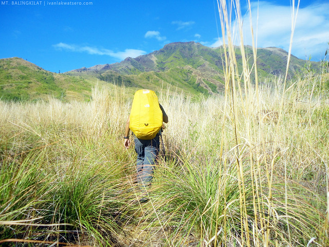 |
no shaded place to hide from the sun.
SPF 100 not enough. |
 |
| although it was really hot during our trek, the clear sunny day allowed us to see the mountain unobscured, which for me is truly beautiful. |
The first hour was technically easy and really manageable, there were no ascents or steep assaults met along the way. But since the trail runs along an open area (
merong mga puno pero kaunti at maliliit lang, yung iba tuyot pa), we were so exposed to the energy-draining heat of the sun. It felt like we're walking in the middle of a desert, and will collapse due to heat stroke anytime. The trail may be very easy, but the situation made it one of my most challenging, energy-draining mountain treks.
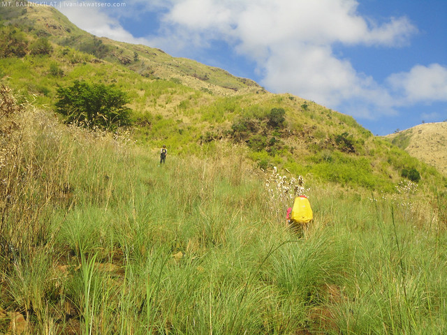 |
sadyang nakapanlulumo ang unang oras ng paglalakad
All I had in mind while trekking was "shade". I want shade! |
We were happiest when we reached Kawayanan Campsite at around 09:30 AM, a shaded area at last. It is the only shaded campsite in the entire mountain and the last water source throughout the ascent, said our guide. After knowing this, our group decided to stay long and have an early lunch in the area.
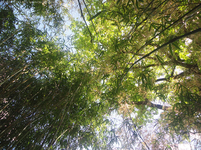 |
| this grove of bamboo, most certainly a gift from above! |
When we were about to resume the trek after lunch, time was only 11:30 AM, we realized that the sun outside the bamboo grove was no longer tolerable by mere mortals. Whoever stays outside the grove will surely get toasted instantly.
Oh gosh,
it was excruciatingly hot!
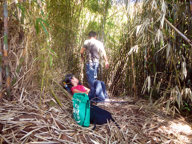 |
| When Dane suggested that we stay at the campsite and wait until the heat dwindles down, everybody readily agreed. |
To save ourselves from the unmerciful sun, we decided to extend our stay at the campsite and wait until it is bearable again to trek outside. So for the mean time, we took a nap. The next thing I knew, it was already 2PM.
Medyo napasarap ang pahinga namin, umabot nang halos 3 oras, hehe.
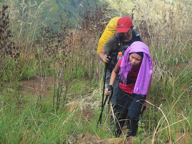 |
| We resumed the trek at around 02:15 PM, mainit pa rin pero kaya nang tiisin. |
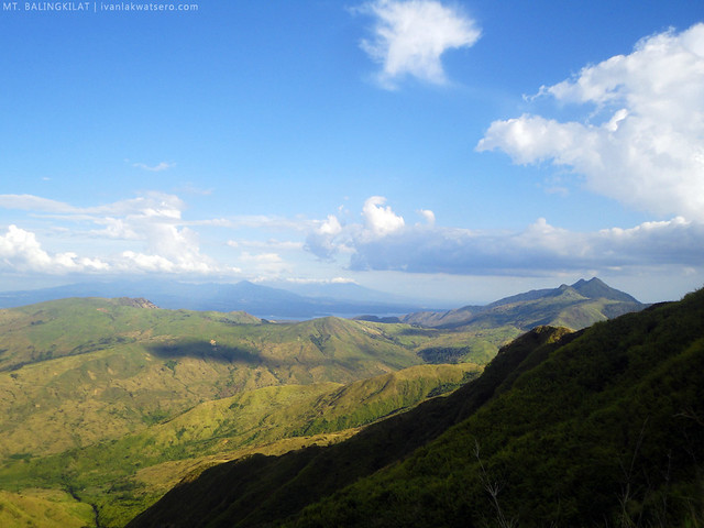
The trail beyond Kawayanan Campsite was zigzaggy, slightly steep and entirely covered with tall grass. It means, of course, that the trail is exposed to sun. Luckily, patches of trees would appear from time to time, offering shade to us, weary and feeling so drained.
 |
| Mt. Pinatubo (NE) seen from the trail. |
 |
| Mt. Cinco Picos (S) and Mts. Natib and Mariveles (SE) also seen from the trail |
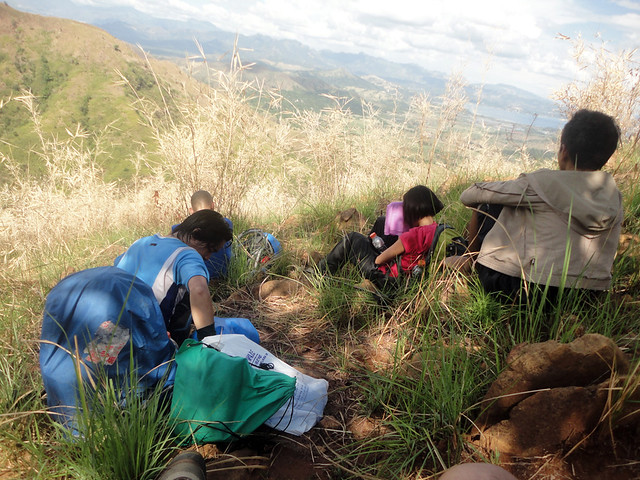 |
| life-saving shade! |
 |
| kapag mahangin sa trail, we would rather stay on that spot for like 10 minutes. |
As we near the summit area, the trail started to look familiar. It began to resemble Tarak Ridge, there were edgy boulders, steep assaults, and the terrain was covered mostly with talahib, and it was windy too. It was already 05:30 PM, so the sun wasn't a problem anymore.
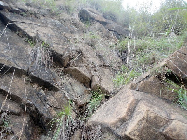 |
| semi-bouldering before the near-summit campsite |
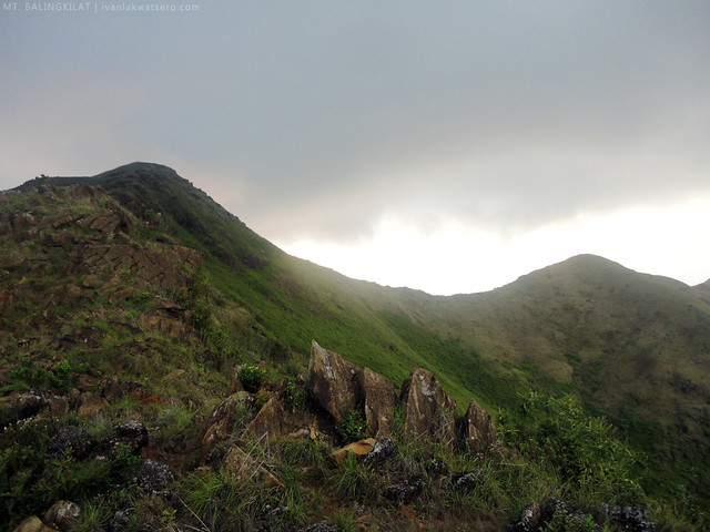 |
by 5:45 PM, we reached the rocky near-summit campsite.
approx 4 hours trek from Kawayanan Campsite |
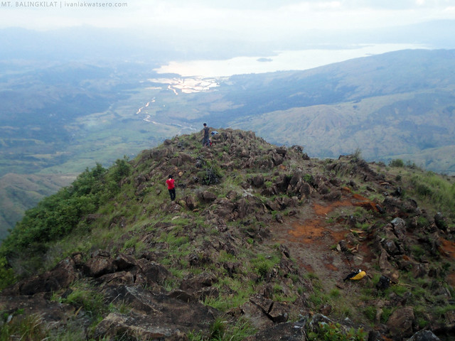 |
| there was supposedly a water source near this campsite, but since it's summer time, there's none. |
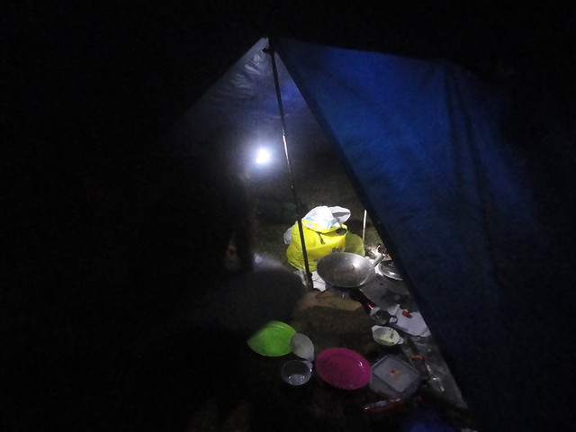 |
| night time soon came in |
Contrary to what we've experienced during the day, the night time at the campsite was so damn cold. It was windy, but not as much as Tarak Ridge, but still really chilly. Soon after feasting on the dinner, lights were turned off .
Day 2 - March 24, 2013
The following morning, we woke up on a very foggy place. The campsite was engulfed by thick layers of fog, there's almost nothing to see beyond 5 meters distance.
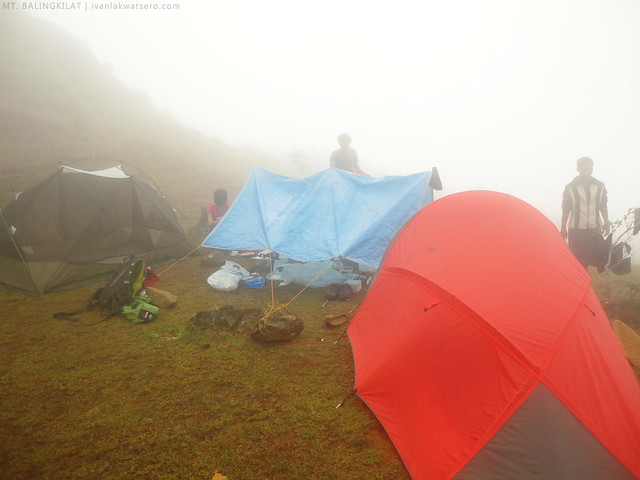 |
| foggy morning |
 |
| we still went up to the summit though, despite our very slim chance of seeing the view from top. |
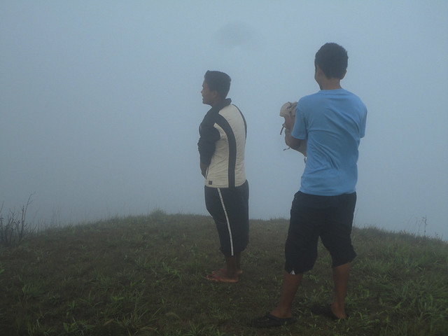 |
but as expected, we had no view from Balingkilat summit.
sayang, kita sana lahat ng coves ng Zambales |
We did not give up so soon. We probably stayed at the summit for 10 minutes, hoping that the fog will give way for the view. But meh, we waited for nothing. So we just went back to our camp, ate our breakfast hastily, then packed up everything to continue the traverse.
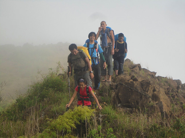 |
we resumed the trek at 07:30 AM.
No sun yet, thanks to fog |
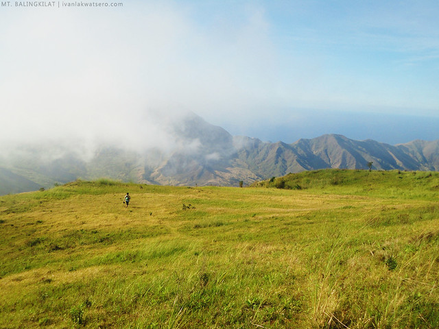 |
| we reached this plateau at around 07:40 AM. It's pretty much a large campsite, could accommodate a hundred tents. There's also a water source nearby, but again dry during summer. |
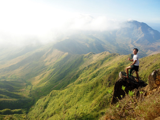 |
| of course, I rushed to this rock when I saw it. Another life-on-the-edge photo for me. |
Along its southern ridge line, we descended Mt. Balingkilat for about 3 hours to Nagsasa Ridge (aka Mt. Nagsasa). Perhaps it is the most challenging part in the entire traverse. Most of the times, we had to go over many rocks with sharp edges, some were even loosely placed, thus risky. And again, there was no shade nor a water source along the trail.
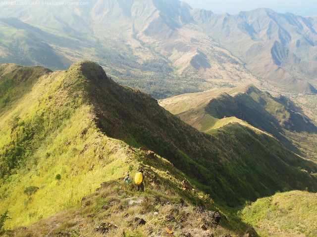 |
| descending along the ridge line |
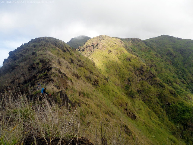 |
| Mt. Balingkilat summit viewed from the ridge. |
Mid-way, we ran out of water and the next water source is in 2 hours
pa raw. Oh god, I was starting to feel dehydrated. And another thing
, nagsisimula na rin tumindi ang init ng araw. Too much ordeal for our group. Our situation left us with no other choice but to push for the water source the fastest we could.
 |
but despite the challenges, I still enjoyed the trek very much.
view pa lang napapawi na yung pagod ko |
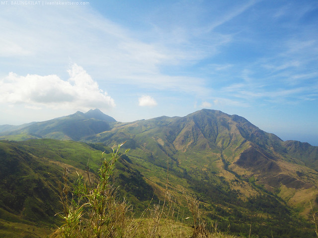 |
| the other major peaks in Subic-San Antonio mountain system, Mt. Cinco Picos on the left, and Mt. Dayungan to the right. |
It was by 10:00 AM that we finally reached Nagsasa Ridge. From there, we rushed to the water source, which is just 15 minutes away.
 |
| we were so relieved we we reached the water source. It was like an oasis in a middle of a desert, heaven! Some of us even dipped on the pool para lang mapreskohan. |
From the water source, the trail has become more gentle with Agoho trees all over. We also passed by some river systems that have totally dried up.
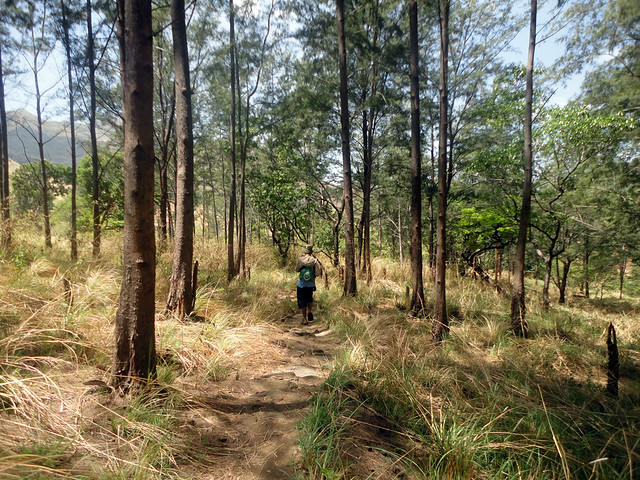 |
| salamat sa mga puno, hndi na masyadong matindi ang paghihirap namin. |
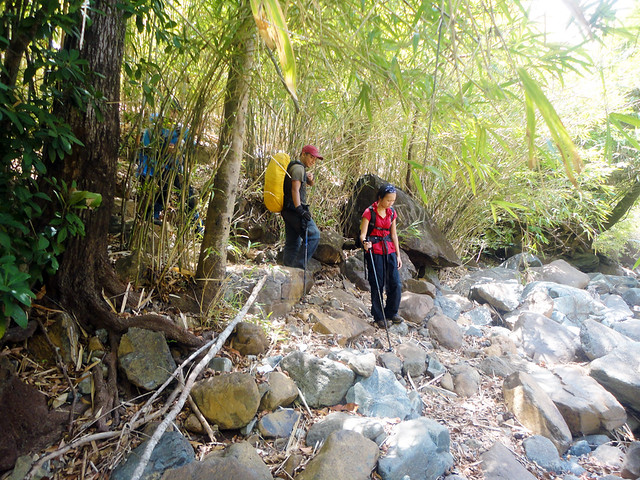 |
| During summer, the river is totally dry. But it could swell so deep during the rainy season, according to our guide |
 |
Mt. Balingkilat as seen from below.
nakakatuwang isipan na nanggaling pa lang kami sa tuktok and descended through that ridge. |
Since it was almost mid-day, the sun intensified greatly. Agoho trees just suddenly vanished as the trail turned into a talahaban again the closer we get to Nagsasa beach. "
Arrggh, sobrang init na naman!! I will definitely buy a bottle of coke on the first store I would encounter," I told myself.
 |
| approaching Nagsasa Cove |
_________________________________________________________________________________
I'm so glad we made it, successfully traversed Mt. Balingkilat. Big thanks to Agnes for arranging this climb, which I truly enjoyed despite the extreme challenges. Thanks to our young guides as well, Tom and his friend.
Done with my 38th mountain.


yan life-on-the-edge na yan ah.. ingat ingat din pag may time.
ReplyDeleteObviously, none of you suffered from heat stroke this time, but it is always a possibility when you do a climb in intense heat with limited water supply. Don't push your luck too far.
ReplyDeleteSa mismong araw din ba sir kukuha ng permit pag aakyat ng balingkilat or in advance? Magkano po budget jan when food is not included?
ReplyDeletewould be better if you arrange everything, permits and guides, prior to your climb. To do that, keep in touch with chieftain Jimmy - 09219543215. our budget was around 1800 without the food.
DeleteExciting! ♥
ReplyDeleteumakyat kami jan nung february.. kaya lang nag ka bush fire while we're in kawayanan..
ReplyDeleteAng ganda nang view!
ReplyDeleteSir, from nagsasa cove, pano kayo bumalik, trek uli or nagpa sundo sa boat? Thanks!
ReplyDeletenagpa-sundo kami sa boat.
DeleteHi Campers,
ReplyDeleteIf you need assistance, Boat, tents and etc.
Please let us know by calling or texting us.
We’ll try our best to assist you.
Contact Person: Dindo or Liezel Nieva
Contact Number: 09172022692/09995959623
Blog site: http;\\dindonieva.multiply.com
Hello. ask ko lng kung pede dna kumuha ng guide dto sa mt balingkilat??
ReplyDeletehow much po ung registration sa sitio cawag?
ReplyDeletehow much po ung registration sa sitio cawag?
ReplyDeletebetter keep in touch with Chieftain Jimmy regarding the updated rates in the area. 09173712189. Thank you :)
Deletehi were planning to do this iterinary..is there any aupdate with the contact person?
ReplyDeletebetter keep in touch with Chieftain Jimmy regarding the updated rates in the area. 09219-543215- 09093732-926
DeleteWe climbed this mountain last Jan 8-9. It seems that our guide took us in a different trail. We didn't have a trail with those trees and we didn't take the bridge going to Nagsasa. Plus our guide wasn't accomodating and even complaining to us.
ReplyDelete