Well, this was the story before Kaybiang Tunnel was completed at the foot of Mt. Palay-Palay.
Upon learning that Kaybiang Tunnel has been passable for quite some time now (it was inaugurated last July 2013), I hastily and excitedly organized a day hike in Pico de Loro. It was actually because of the tunnel that I'm doing a traverse, finally.
_____________________________________________________________________________
Sunday - September 8, 2013
With the new Southwest Integrated Bus Terminal System, we headed to Coastal Mall Terminal early in the morning of a Sunday. We're bound to Ternate, Cavite for a quick traverse dayhike of Pico de Loro. I've hiked the mountain twice, but only now that I'm doing a traverse, so naturally, I am very much excited to see what's waiting for me in there.
 |
| at Southwest Integrated Bus Terminal in Coastal Mall. All the bus bound for Cavite and Southwest Batangas are now stationed here. |
 |
| photo ops muna along the trail to the peak |
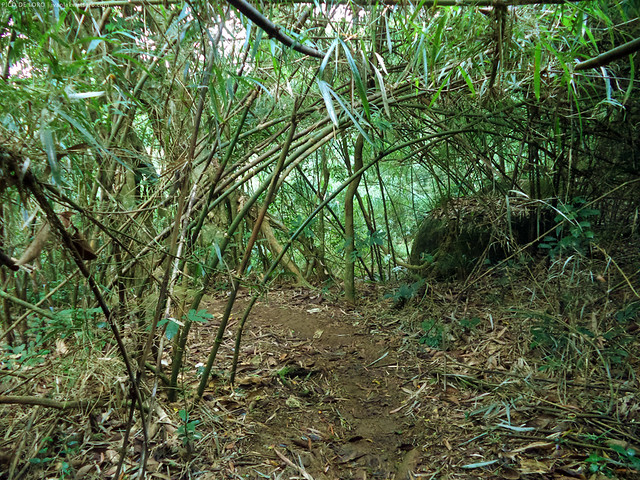 |
| the bamboo forest right before reaching the saddle campsite |
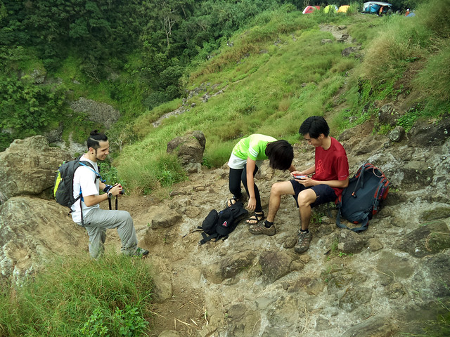 |
| take 5 muna! |
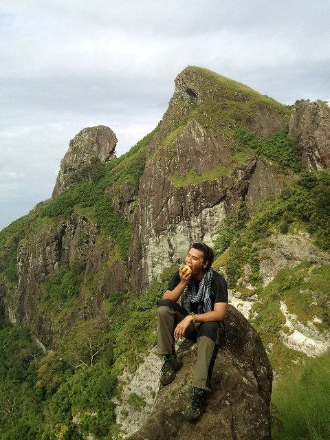 |
| Syempre we took the opportunity to take photos as we rest at the saddle campsite. It's here that hikers can see fully and up close the Parrot's Beak |
 |
| the Rock Tower, or famously known as the the Monolith as seen from the summit of the mountain. |
 |
| Mt. Batulao rising above the clouds |
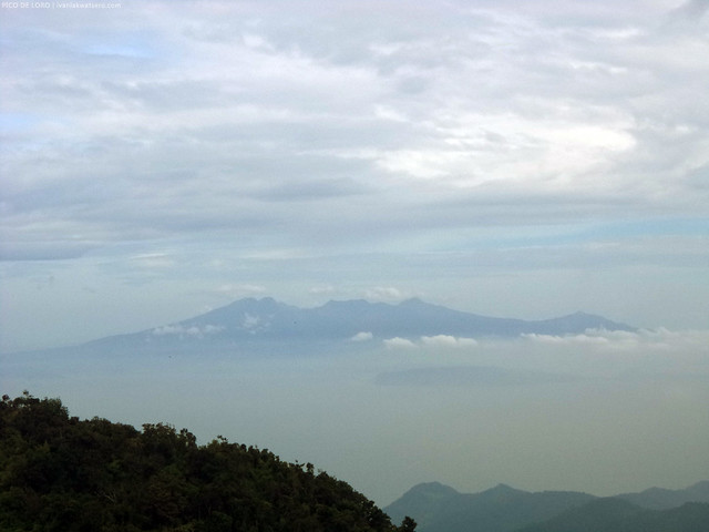 |
| Mt. Mariveles as well as Corregidor Island, spotted from the summit of Pico de Loro |
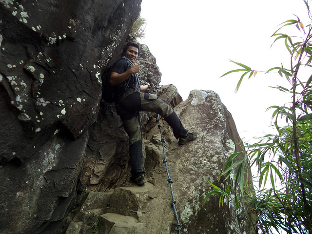 |
| it's easier with the rope. I've experienced climbing it without one. |
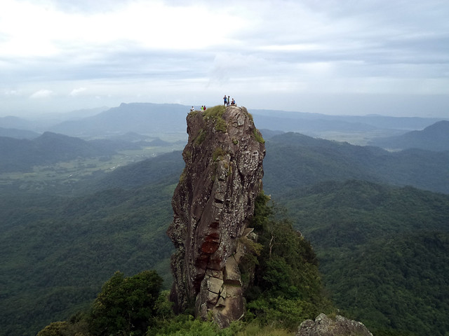 |
| there they are, at the top of the monolith. |
Traverse to Nasugbu
As soon as we finished taking photos and selfies at the rock, we continued with the day's goal—traverse to Nasugbu. We descended the trail found at the foot of the rock tower.
I was surprised that the first few meters of the trail, starting from the foot of the monolith down to the bamboo forest, was overwhelmingly steep or almost vertical. And the loose ground makes it slippery. It was also quite overgrown for the obvious reason that only a few uses this trail.
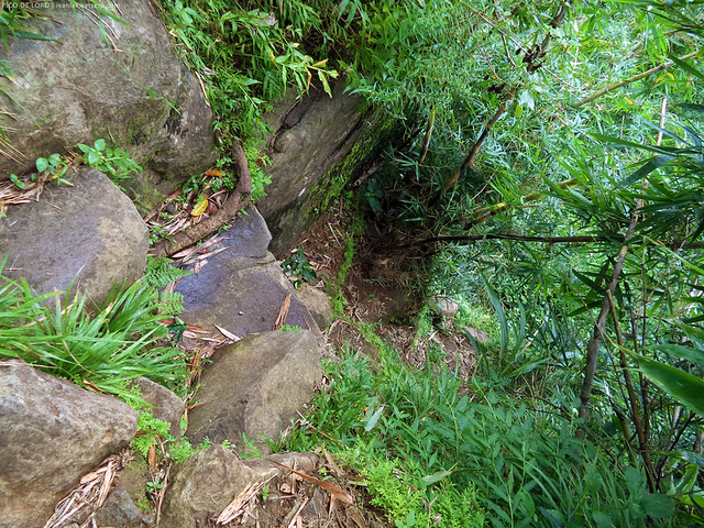 |
| the almost vertical trail to Nasugbu which can be easily found to the right of the rock tower. |
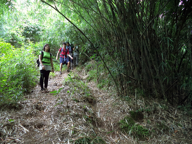 |
| easier trail beyond the bamboo forest |
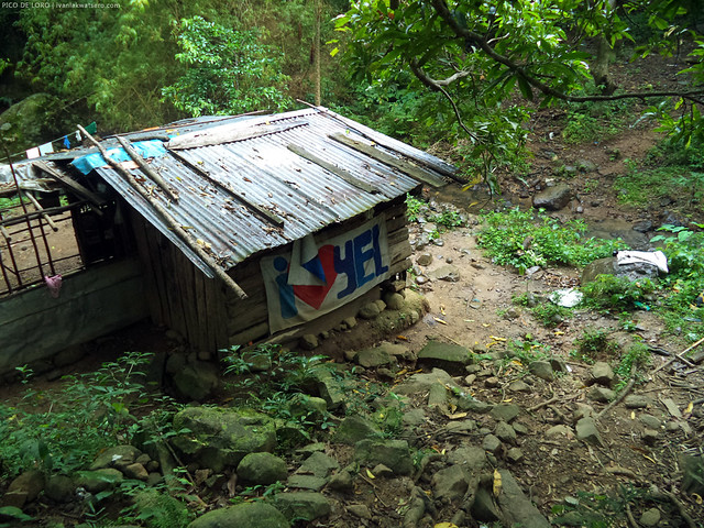 |
| almost finish |
 |
| end of traverse |
Kaybiang Tunnel
Ever since I heard of Kaybiang Tunnel, my feet itched to visit it. Why is that so? Here are the facts about the tunnel:
• It is currently the longest of its kind in the Philippines. Like how long? Three hundred meters!
• The tunnel was drilled through a chunk of the foot of Mt. Palay-Palay to finally connect the towns of Ternate in Cavite and Nasugbu in Batangas.
• It took 4 years to construct this tunnel.
• With this tunnel, travel time from Nasugbu to Ternate, or vice versa, was significantly cut shorter. Vehicles need not to take the long way round via Tagaytay city.
Now going back to our adventure..
We wanted also to visit Kaybiang Tunnel that day so we decided to return to DENR station. We had 2 options, either we ride a trike back to DENR, or punish ourselves with another 10+ kilometers walk along the highway. The crazy us opted the latter.
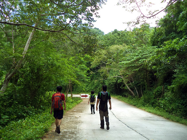 |
| still a long way to go. |
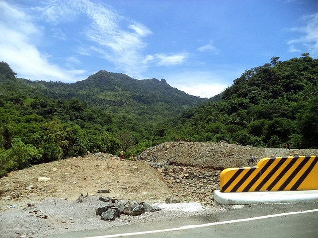 |
| Pico de Loro's west face as seen from the road. |
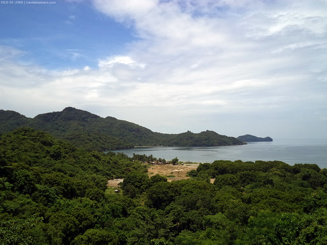 |
| beautiful coastal scenes from the road |
Before we continued back to DENR, we dropped by the tunnel to check it out. I was surprised to see that we're not the only ones being tourists in the tunnel. All the motorists, all the passers by would stop for photo ops. Apparently, the tunnel has evolved into a tourist attraction. cool!
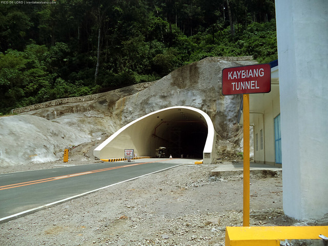 |
| We rode the tricycle and asked the driver to drop us here. At last, the Kaybiang Tunnel. |
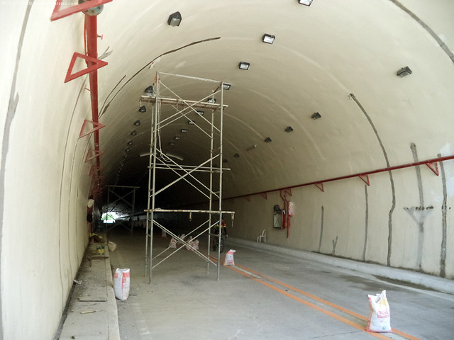 |
| with all the works still going, obviously, the tunnel wasn't totally complete yet, but it's already open to light vehicles at least by the time we visited. |
________________________________________________________________________________
Traverse hike of Pico de Loro was completed, at last! May bonus pang visit sa Kaybiang tunnel. Thanks to all who joined this hike!
Read also my previous Pico de Loro hikes in the following links.
1st Pico de Loro
2nd Pico de Loro

Slow clap.. idol. Galing. You have renewed my interest in this mountain. Maybe, just maybe, I will come back for the trav. Again, awesome photos!
ReplyDeleteCheers!
idol... bka pwde nmn sumbit s mga susunod n akyat mo bihira nlng kc umkyat ung mga kagrupo ko eh
ReplyDeleteidol... bka pwde nmn sumbit s mga susunod n akyat mo bihira nlng kc umkyat ung mga kagrupo ko eh
ReplyDeleteidol... bka pwde nmn sumbit s mga susunod n akyat mo bihira nlng kc umkyat ung mga kagrupo ko eh
ReplyDeletesir, magkano po pamasahe sa tricycle from nasugbu side to denr?
ReplyDeleteduring this hike, we only paid P50 I think. Inulit ko itong traverse na ito recently and meron na ngayon terminal ng tricycle sa Nasugbu Jump-off, hindi ko lang sure kung magkano ang singilan :)
Deleteok. thanks, sir! :)
DeleteSir?may required month po ba ang pag punta sa mt. Pico deloro? .december po sana ang balak namin e.
ReplyDeleteSir may required month po ba ang pagpunta dyan? December sana balak namin e.
ReplyDeleteAny itenerary po sana. :-)
ReplyDeleteFor mt.pico de loro tranportation service contact us at 09264145429, we're open to all mountaineer 24hrs.
ReplyDeleteFrom: anypoint of cavite to jump off point at ternate cavite forestry or for doing traverse in nasugbu batangas
Hi Ivan.
ReplyDeleteNeed pa ba ng guide? or kaya naman sya akyatin without guide?
Thanks!
Magkano po nagastos nyo lahat lahat? simula sa pagsakay sa bus station? May balak po kasi kami ng friends ko, just in case para di kami maloko.
ReplyDeleteSir madali lang po ba yung traverse hindi po ba nakakaligaw.we plan of traversing pico to keybiang po sana eh.from d monolith mga ilan oras po kya marating yung hiway?and from hi way to keybiang estimate po ninyo kung lalakarin lang?salamat po
ReplyDeleteFrom monolith it's purely descending. always turn right pag may forking trail. May mga trike naman sa hiway kaya pwede na kayo sumakay papuntang kaybiang then pabalik sa denr.
Deletesir, mga ilang minutes po kaya ung travel time from firing range pabalik ng denr via kaybiang tunnel by tricycle?
ReplyDeletehi. napaplan po kasi kami na mag beach sa nasugbu after ng hike, san po ba pede wala po kasi kami alam sa batngas, and yun car po ihahatid po kami sa ternate, anu po ba un malapit na beach sa nasugbu na pede pong dun na dumiretso un driver!? tnx
ReplyDeletehi, pag nag traverse po ba kami ternate to nasugbu, my beach na po agad? tnx
ReplyDeleteGanito rin po plano namin this july.. May beach nga po ba malapit?
DeleteHow can we go to nasugbu beach after doing a traverse hike at pico?
ReplyDeletePwede bang maglakad sa loob ng Kaybiang Tunnel patawid sa kabila ng tunnel?
ReplyDeleteYes, pwede po.
DeletePaano po magcommute papuntang Coastal bus Terminal sa umaga? May bus po ba papunta doon? Galing po kasi akong Cubao. Thank you.
ReplyDeleteHey there! may contact po ba kayo ng guide? salamat
ReplyDeleteHi there. We are hoping to stop at Pico De Loro on our way to Punta Fuego. Is it a possibility to do the hike this coming Saturday Morning? Can we do it on our own, or do we need a guide? Should we make a reservation? Thanks, Marylu
ReplyDelete